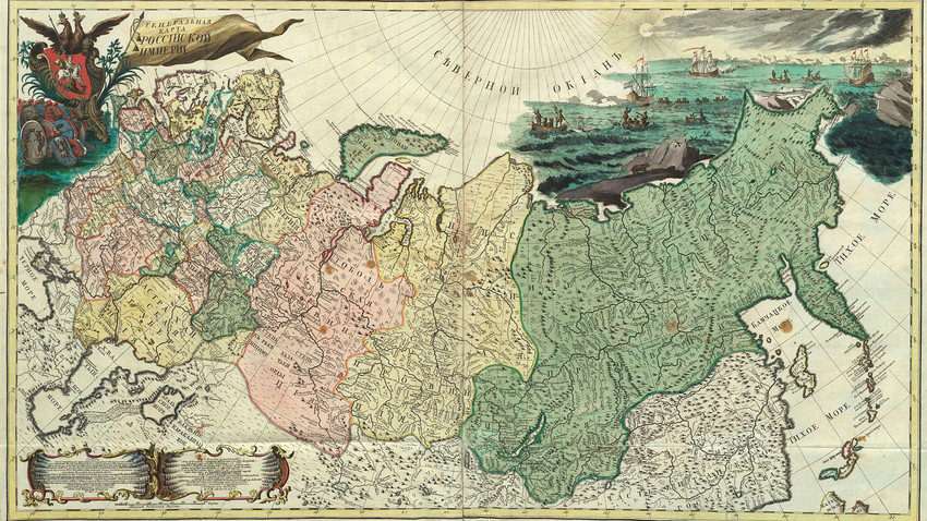
Atlas of Russia (1745).
Russian Academy of Science / WikipediaThe first efforts to map Russia were attempted in the 16th century, but detailed drawings of the country appeared only at the end of the 17th century, and genuine geodetic work started only under Peter I.
On Sept. 13, 1745, the first edition of the geographic Atlas of Russia was issued, and included 19 maps of Russia’s provinces and one general map. It was compiled and published by the Academy of Science under the leadership of the great mathematician, Leonhard Euler.
The Atlas was translated into German, French and Latin.
If using any of Russia Beyond's content, partly or in full, always provide an active hyperlink to the original material.
Subscribe
to our newsletter!
Get the week's best stories straight to your inbox

